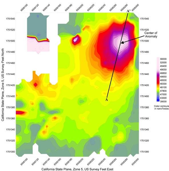
A geophysical investigation was conducted at a one-acre vacant lot in Los Angeles County, California to delineate the surface trace of abandoned steel cased oil wells. Spectrum collected cesium vapor total field magnetics data at one-foot intervals (integrated with a NavCom SF2050-G GPS unit) along parallel traverses 10-feet apart. Site features were mapped using a Trimble ProXR GPS unit. Once the data were acquired, a detailed map of the surface cultural features was made and the data were color contoured in the field to identify anomalies present at the site.
A significant monopolar anomaly was identified in the magnetics data at Easting 6506280, Northing 1751495. The amplitude of the anomaly was approximately 1000 nanoTeslas above background, and its size and character were typical of abandoned oil well anomalies. Spectrum attempted further investigation of the anomaly with a handheld metal detector but were unable to verify its source. The anomaly location was marked on the ground by the field crew. Because subsequent attempts at shallow excavation by the Client did not uncover the well, Spectrum calculated the depth and location of the abandoned oil well using the half-width rule for a monopole method. Based on these calculations the depth of the well was determined to be between 40 and 50 feet, and its location was revised to approximately 10 to 15 feet magnetic north of the anomaly center.